Chinese engineers make sci-fi drone mapping reality
Share - WeChat


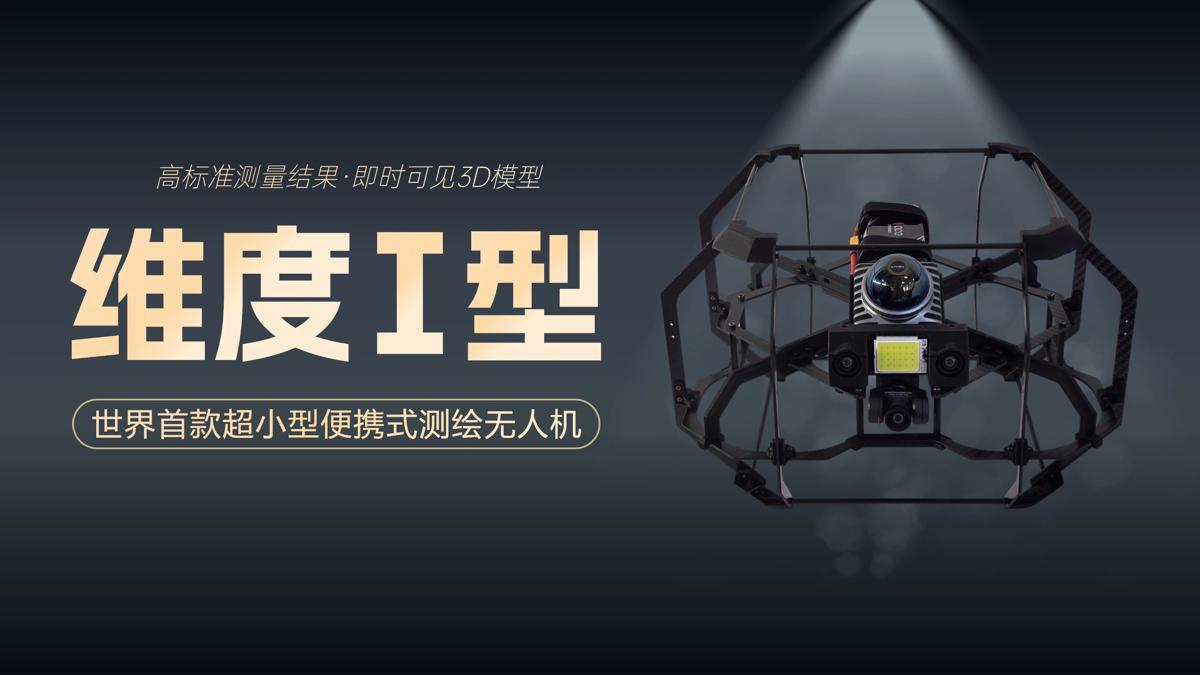
A scene from the science fiction film Prometheus, where explorers deploy a mini-drone that laser-scans caves to generate 3D models instantly, has turned into reality, thanks to the efforts of Chinese engineers.
On Tuesday, the Spatiotemporal AI Perception Technology Innovation Center at the Tianfu Jiangxi Laboratory in Chengdu, Sichuan province, announced that it has launched Dimension 1, the world's first ultra-compact portable mapping drone. It is designed to perform asset digitization scanning tasks in indoor environments.
- Ferry routes and schools closed as Typhoon Tapah nears Guangdong
- Xi to attend BRICS leaders' meeting via video link on Sept 8
- China activates emergency flood control response in Guangdong, Guangxi
- Australian expert lauds China as a global leader in nanoscience
- Freight train loaded with goods leaves Guangzhou as it heads to Europe
- Typhoon Tapah triggers Level-IV warning in South China island province


